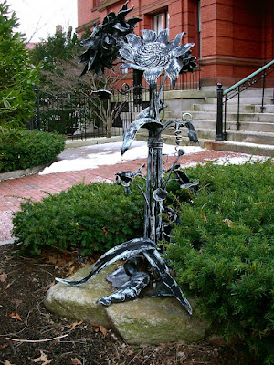


Studies in Digital Media is a class I'm taking this semester, and the group assignment is one utilizing google maps, where we pick an aspect of city life to map and then all compile the results. Our project is for public art, and on the map we're going to differentiate between active/passive sites where activity/participation is occurring with the sites.
One thing I realized while walking around taking these photos this morning is that summer may be a better time to really diagnose these sites as they are, since the winter/spring in which we're in may be a more dormant time for catching people interacting with these pieces.
Some are definitely corporate by nature/location, and others seem more forgotten about. That's the aspect of this project I'm really interested in- forgotten public arts that have awkward placement, or just seem to have been forgotten about. There are a lot of murals I can think of around the vicinity that are such that, but traveling to them requires a vehicle, so I hope to get those in before Thursday nights class.
After I add these into our google map I'll post an edit that links to the project.


No comments:
Post a Comment